
Site Visual Progress Analytics
Preimage turns every site scan into a time-stamped 3D record, helping you track progress, validate work, and share visual proof, without extra site visits or manual effort.

Put the Power of Preimage in Action
Capture, visualize, and analyze in 3D on the Preimage Platform.
Track Progress Over Time
Preimage builds a visual timeline of your project so you can track work-in-place, step by step.
- See all site activities in sequence
- Monitor milestones from demolition to handover
- Generate automated reports, raise RFIs, add comments, and collaborate with your team


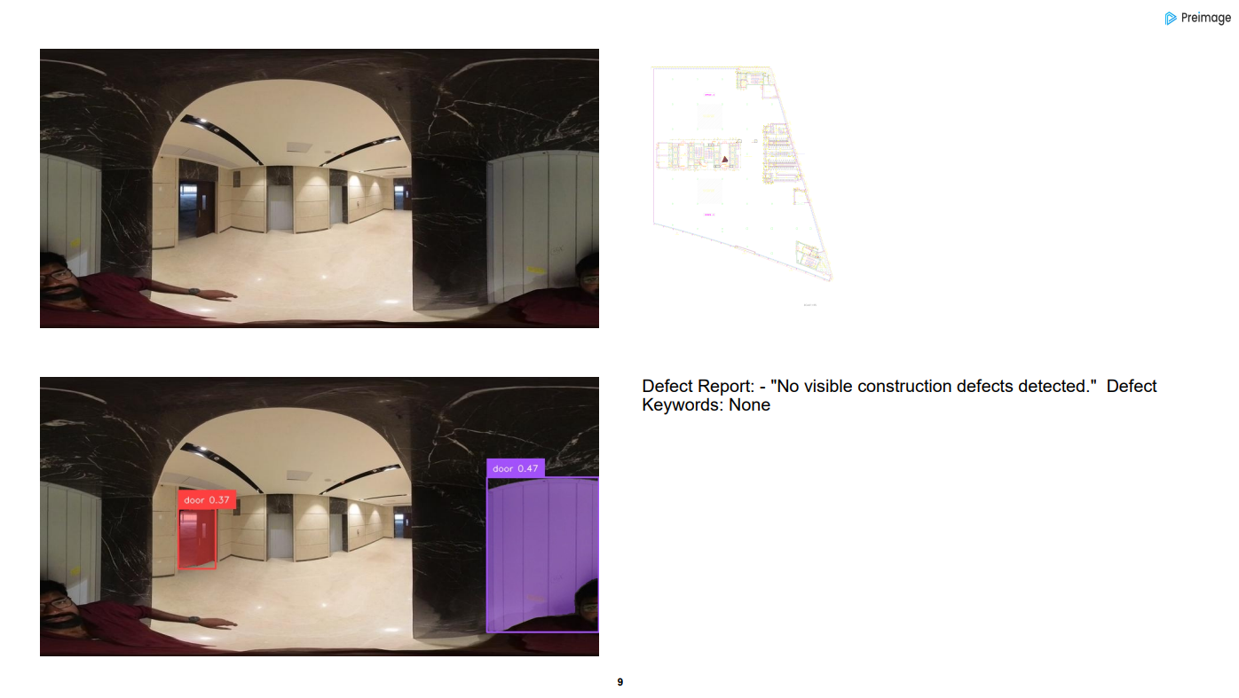
Detect Changes and Deviations Instantly
Compare any two captures and let Preimage’s AI highlight exactly what’s changed.
- Spot missing or incomplete installations like walls, partitions, ceilings, or MEP elements
- Detect deviations from floorplans, BIM models, or approved design drawings
- Use segmentation and AI detection to identify installed, removed, or altered components across site scans
Deliver Visual Proof to Clients and Teams
Turn your site data into easy-to-share reports for stakeholders and clients.
- Export progress snapshots with timestamps
- Generate AI-powered progress summaries
- Share PDFs or live links, no special tools needed to view
Trusted By 100+ organizations across the world


Features that
set us apart
Discover cutting-edge features that transform 3D scanning into a seamless process - delivering precision, speed, and immersive digital experiences for your projects.

Precision Tracking You Can Trust
Capture work-in-place with centimeter-level accuracy for reliable progress validation.

AI-Powered Progress & Deviation Analysis
Instantly calculate quantities and detect deviations, no manual effort required.

Shareable Visual Reports
Share time-stamped insights and measurable proof with clients and teams in real time.

Seamless Integrations
Sync your Preimage data with Autodesk tools to connect site reality with design and project management workflows.
Our Solutions
Preimage uses AI to turn 360° videos and drone footage into accurate 3D models. This helps with tasks like property digitization, construction tracking, urban planning, and virtual tours, making it easier to manage and share real-world spaces digitally.

Sales & Marketing Insights
Boost property visibility and engagement with virtual tours and viewer analytics to provide rich, data-driven presentations for prospective buyers and stakeholders.

Urban Planning & Surveys
Enable efficient urban development and infrastructure projects with drone-based surveys, 3D mapping, and GIS insights to support zoning, planning, and smart city initiatives.

Progress Reporting & Visual Documentation
Track construction progress and deviations from plan and schedule with 3D visualizations, timelines and comprehensive reports. Enhance facility management with visual documentation for ongoing operations.

Property Digitization
Convert physical spaces into accurate digital models with 3D scanning and point cloud technology, enabling seamless asset management, design, property inspections, and building renovations.

Interior Design
Create stunning visualizations and precise as-built models for interior design projects using high-quality 3D scans. Streamline workflows, enhance client engagement, and align stakeholders with accurate spatial data and custom layouts.

Engineering Services
Enhance your workflows with custom-built 3D solutions tailored to your use case, our GIS solutions and compliance reports enhance infrastructure management, accuracy, and collaboration.

Construction
Optimize construction workflows with land surveys, progress tracking, and seamless BIM integration for efficient planning, design, and on-site execution.

Commercial Real Estate
Enhance planning and operations of commercial properties like offices, retail spaces, hotels, data centers, and industrial facilities with 3D and BIM models, drawings, and reports to ensure compliance and streamline operations.

