
Explore Preimage's 3D Digital Twins
Explore our 3D digital twins crafted just from photos and videos. Whether you're gaming, urban planning, constructing infrastructure or any other industry, we have tailored solutions just for you.

Featured Showcases
View our 3D digital twins in action and experience the transformative capabilities of our 3D engine.
Virtual Tour
An interactive virtual tour of a property, allowing users to navigate effortlessly through the space, making site visits more efficient and accessible.
.png)
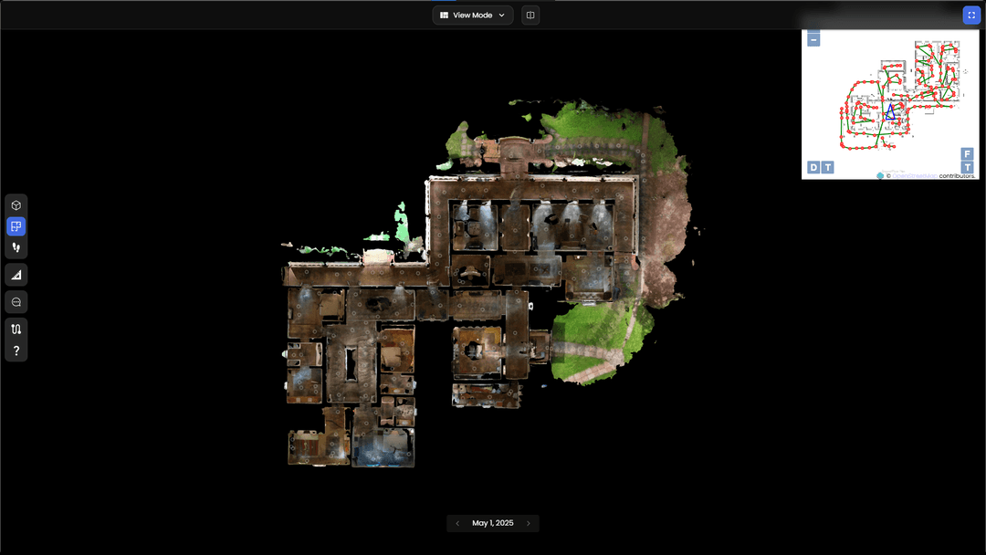
Digital Twin for Large-Scale Facility
A virtual tour of large-scale office space, efficient for asset management, collaboration, and remote accessibility.
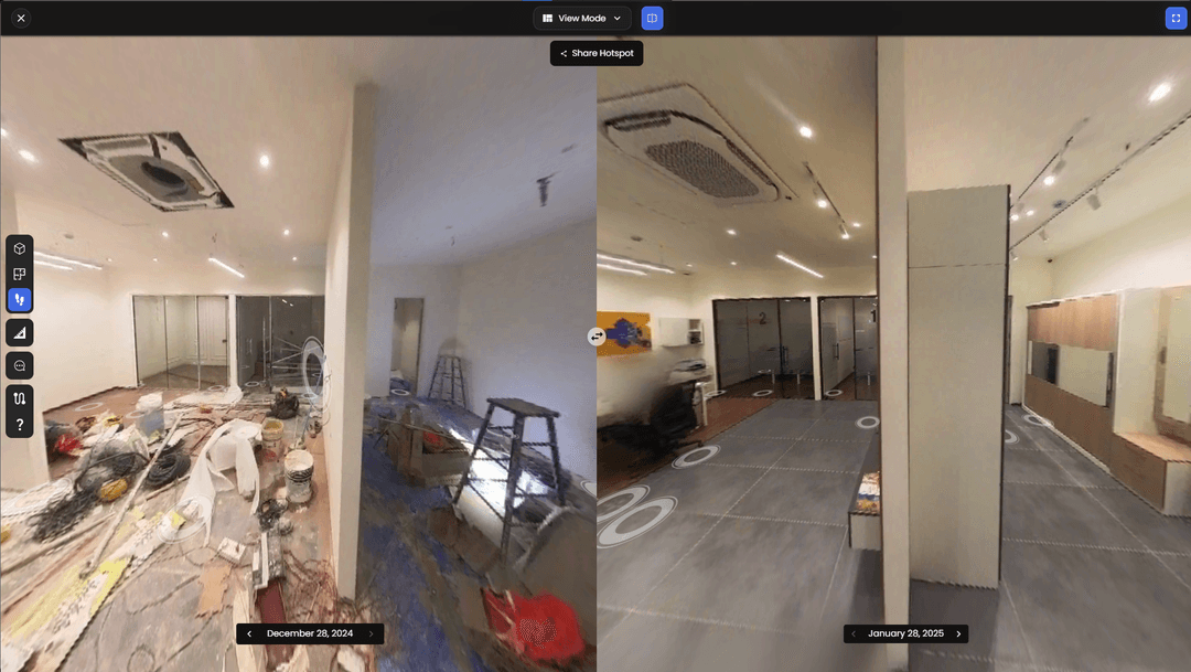
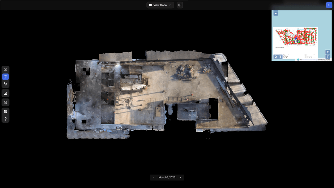
Visualize Change and Track Deviations Over Time
Track modifications in a property by comparing scans over different time periods, helping with renovation planning, maintenance monitoring, and identifying structural or environmental changes.
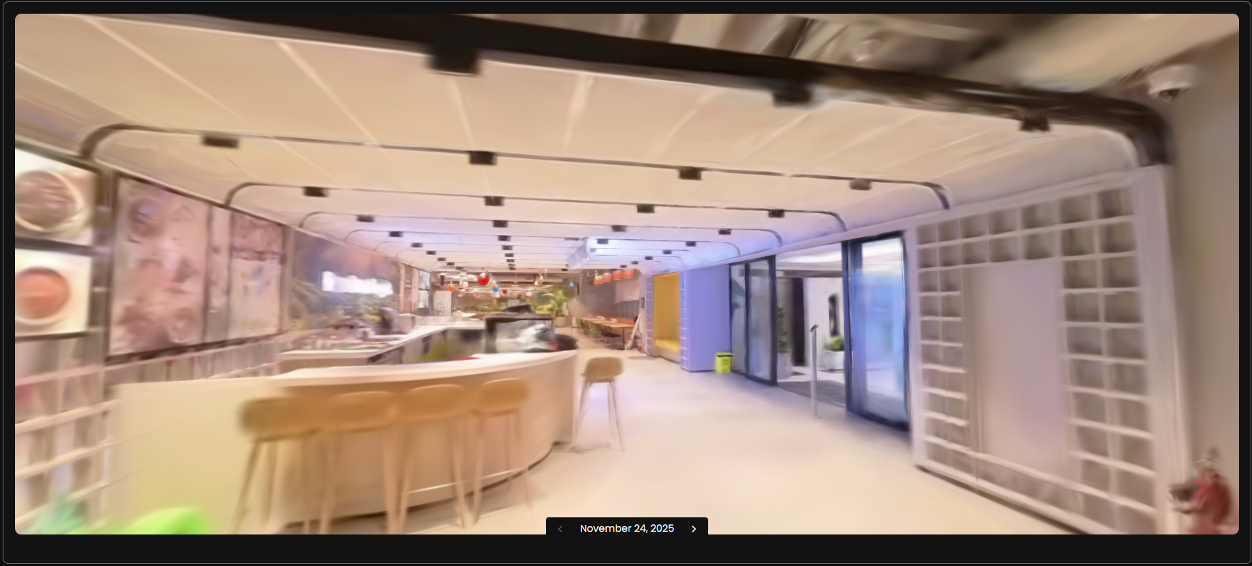
Immersive Tours
A photo-real immersive tour that lets you move freely through the space in true 3D, making remote reviews feel like an on-site walk.

Street Level Imagery
A virtual tour of a site was created using a helmet-mounted camera while driving, ensuring extensive coverage without disrupting operations.

Object Identification for Focused Analysis
AI segmentation to isolate and highlight specific elements within a property, such as furniture, structural components, or safety equipment.
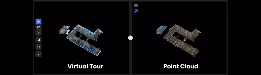
Virtual Tour vs Point Cloud
Compare virtual walkthroughs with high-resolution point clouds, enabling interactive measurements, team collaboration and enhanced spatial understanding in a single interface.
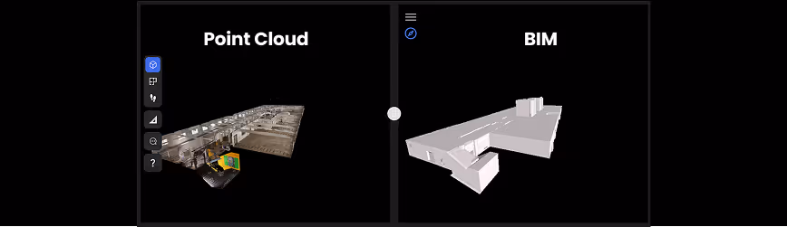
Point Cloud and BIM
View Point Cloud with BIM models in a single interface to streamline as-built verification and reduce modeling time.
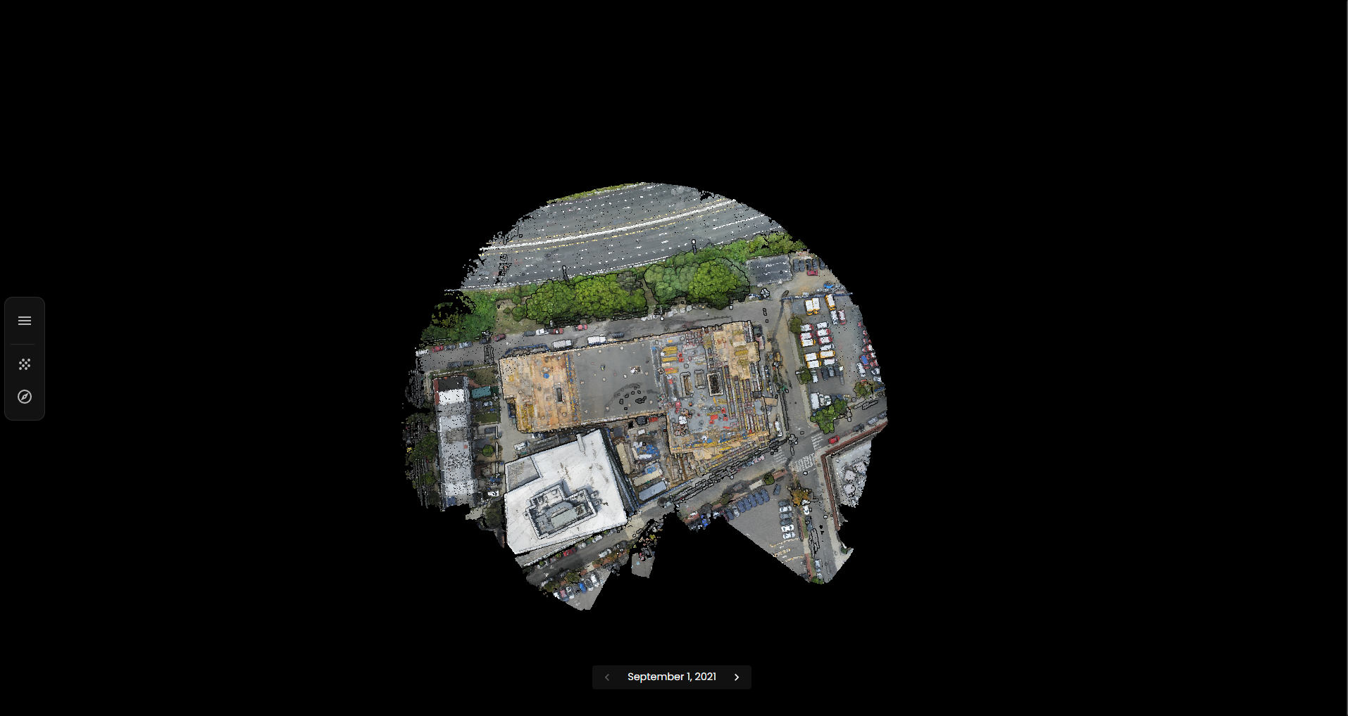
Transforming Drone Capture
A large-scale drone scan of a tech park converted into a high-fidelity point cloud, enabling accurate measurements, site planning, and analysis of vast areas.
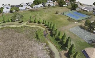
Sheffield Park - Florida
3D textured mesh reconstructed using 172 photographs and 5 GCPs, using Preimage’s neural rendering-based engine.
Trusted By 100+ organizations across the world


Our Solutions
Preimage uses AI to turn 360° videos and drone footage into accurate 3D models. This helps with tasks like property digitization, construction tracking, urban planning, and virtual tours, making it easier to manage and share real-world spaces digitally.

Sales & Marketing Insights
Boost property visibility and engagement with virtual tours and viewer analytics to provide rich, data-driven presentations for prospective buyers and stakeholders.

Urban Planning & Surveys
Enable efficient urban development and infrastructure projects with drone-based surveys, 3D mapping, and GIS insights to support zoning, planning, and smart city initiatives.

Progress Reporting & Visual Documentation
Track construction progress and deviations from plan and schedule with 3D visualizations, timelines and comprehensive reports. Enhance facility management with visual documentation for ongoing operations.

Property Digitization
Convert physical spaces into accurate digital models with 3D scanning and point cloud technology, enabling seamless asset management, design, property inspections, and building renovations.

Interior Design
Create stunning visualizations and precise as-built models for interior design projects using high-quality 3D scans. Streamline workflows, enhance client engagement, and align stakeholders with accurate spatial data and custom layouts.

Engineering Services
Enhance your workflows with custom-built 3D solutions tailored to your use case, our GIS solutions and compliance reports enhance infrastructure management, accuracy, and collaboration.

Construction
Optimize construction workflows with land surveys, progress tracking, and seamless BIM integration for efficient planning, design, and on-site execution.

Commercial Real Estate
Enhance planning and operations of commercial properties like offices, retail spaces, hotels, data centers, and industrial facilities with 3D and BIM models, drawings, and reports to ensure compliance and streamline operations.

