
The AEC industry has long wrestled with a fundamental bottleneck: converting physical spaces into accurate BIM models takes weeks of manual effort, expensive equipment, and skilled modelers. SpatialAI — the fusion of spatial computing and machine learning — combined with Gaussian Splatting is now changing that equation entirely, making BIM automation not just possible but practical for everyday projects.
What Is SpatialAI and Why Does It Matter for AEC?
SpatialAI refers to AI systems that understand and process three-dimensional space — not just images or text, but geometry, depth, structure, and spatial relationships. In the built environment, this means an AI that can "see" a building the way a surveyor does: understanding walls, openings, structural elements, MEP systems, and how they relate to each other in 3D space.
For AEC professionals, SpatialAI is the missing link between raw site data and actionable BIM models. Instead of a surveyor spending days measuring a floor plate or a modeler spending weeks recreating a building in Revit, SpatialAI can process a 360° walkthrough and produce a structured, labeled 3D model in hours.
Gaussian Splatting: The Engine Behind Photoreal 3D Capture
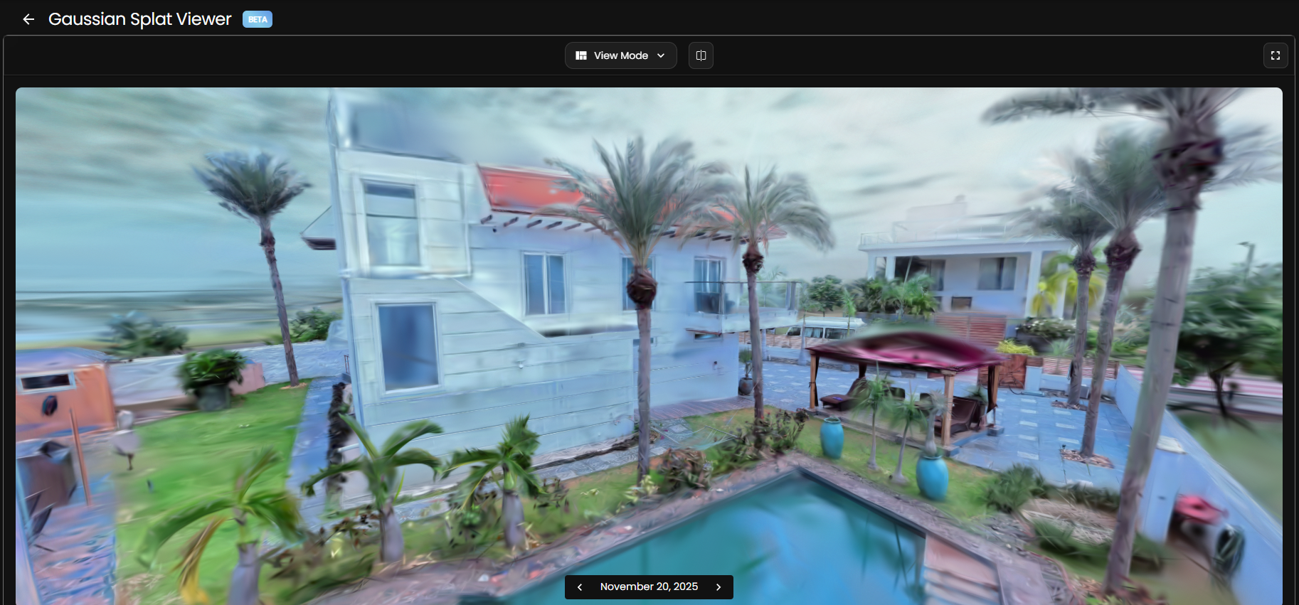
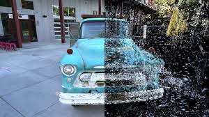
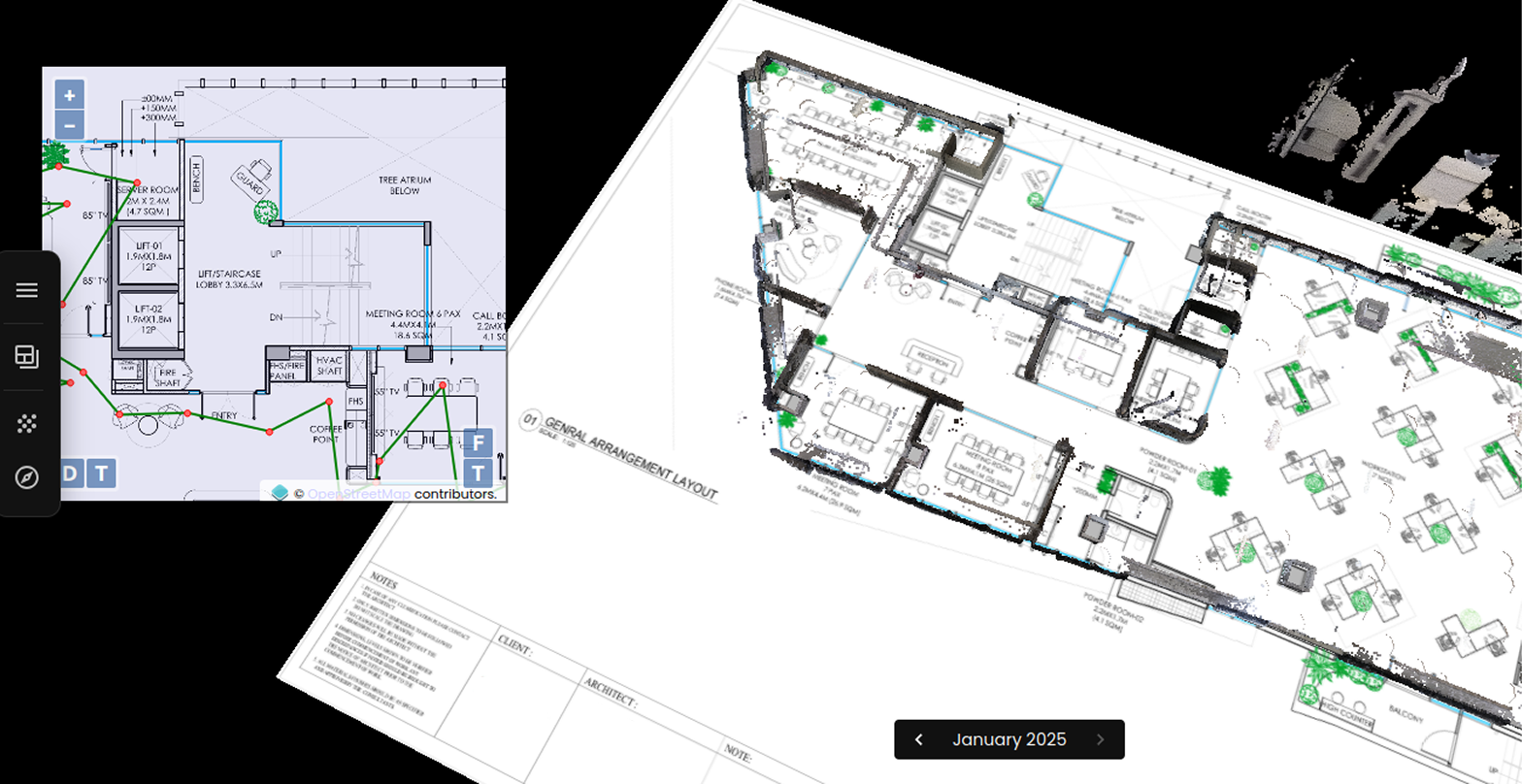
Traditional photogrammetry and LiDAR produce accurate geometry but are expensive, slow, and require specialist equipment. Gaussian Splatting takes a radically different approach: it represents a 3D scene as millions of tiny translucent ellipsoids — "Gaussians" — each carrying color, shape, and positional data. Together they form a photorealistic, navigable 3D environment from nothing more than a 360° video walkthrough.
The practical benefits for construction and facility teams are significant:
- Capture with consumer hardware — A 360° camera like an Insta360 or GoPro Max is all you need. No specialist LiDAR rigs required for most use cases.
- Photoreal output — The resulting model looks indistinguishable from a real site visit, making it ideal for remote reviews, client presentations, and stakeholder sign-offs.
- Fast processing — A typical floor plate can be processed into a Gaussian Splat model in under an hour, compared to days for traditional photogrammetry pipelines.
- Better thin-structure capture — Railings, pipes, and shelving that confuse traditional methods are rendered cleanly in Gaussian Splat models.
From Gaussian Splat to BIM: How SpatialAI Closes the Gap
The real breakthrough comes when SpatialAI is applied to Gaussian Splat data to extract structured BIM information. Where a Gaussian Splat gives you a visually stunning 3D scene, SpatialAI adds semantic understanding — identifying walls from columns, classifying doors and windows, detecting MEP runs, and measuring spatial relationships with millimeter precision.
This is the core of BIM automation: the pipeline from site capture to Revit-ready model no longer requires a human modeler to trace every element. Instead:
- A site team walks the building with a 360° camera in 30–60 minutes
- SpatialAI processes the footage, segments elements, and extracts geometry
- A structured BIM model is generated — walls, slabs, openings, and MEP elements labeled and dimensioned
- The model is exported to Revit, ArchiCAD, or IFC for downstream design work
What previously took 2–3 weeks of manual modeling now takes hours. And crucially, the as-built accuracy is higher — because the data comes directly from the physical space, not from a surveyor's notes and tape measure.
Real-World Applications Across the AEC Lifecycle
SpatialAI-driven BIM automation is already delivering value across multiple use cases:
- Renovation and retrofit projects — Existing buildings rarely have accurate as-built drawings. SpatialAI generates them automatically from a single walkthrough, giving architects a reliable starting point for design.
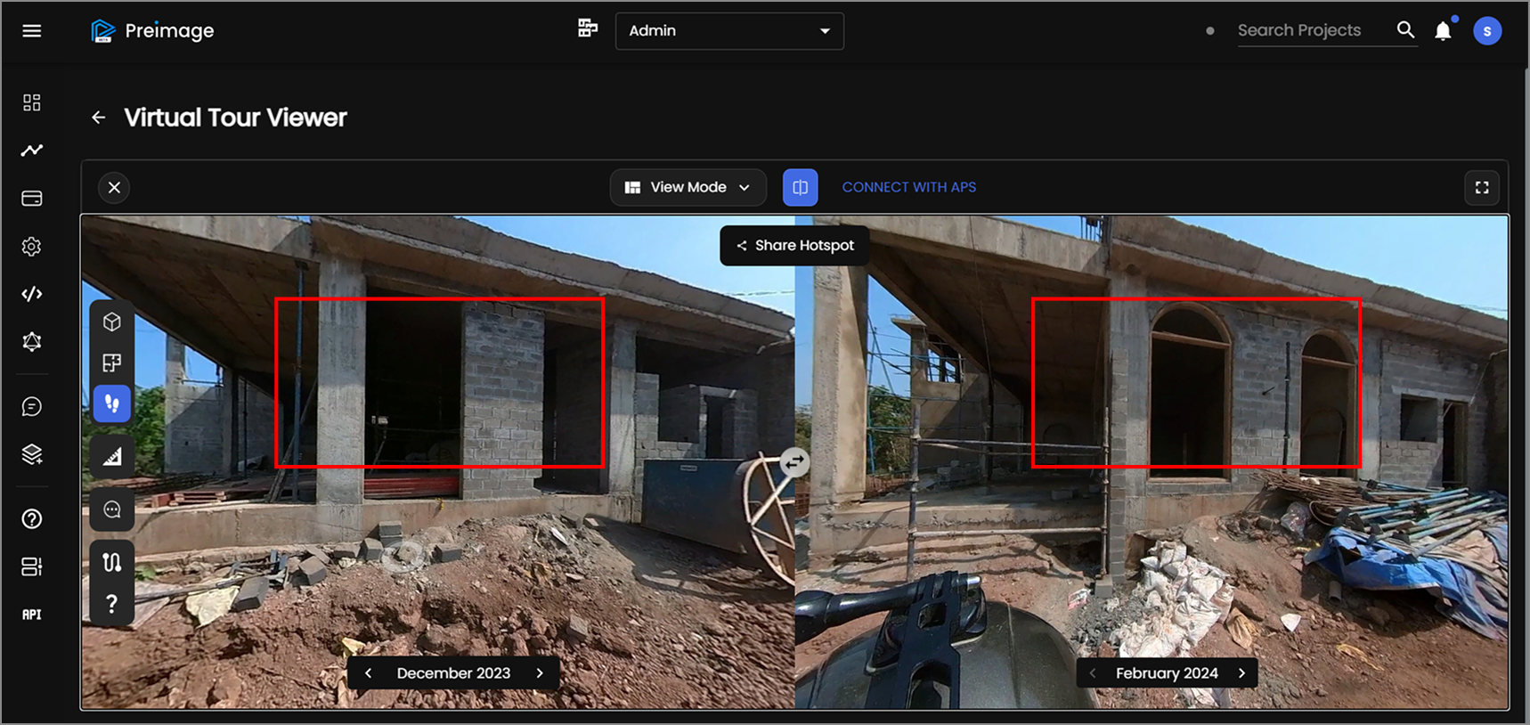
- Construction verification — Compare Gaussian Splat captures taken on different dates, or against the design BIM model, to detect deviations before they become expensive problems.
- Facility management handover — Deliver a photorealistic, dimensionally accurate digital twin at project handover, ready for FM teams to use for maintenance planning and space optimization.
- GIS and urban documentation — Aerial photogrammetry combined with SpatialAI produces georeferenced BIM and CityGML models for large-scale urban planning and smart city workflows.
How Preimage Brings This Together
Preimage combines 360° Gaussian Splatting capture with AI-powered spatial analysis to deliver the complete BIM automation pipeline — from site walkthrough to structured, export-ready model. The platform handles motion masking, semantic segmentation, deviation detection, and BIM export in a single workflow, accessible through a browser with no specialist software required.
For AEC teams looking to cut documentation time, reduce site visits, and deliver more accurate as-built data, this represents a step change in what is operationally possible — at a starting price of ₹1 per sqft.
Ready to see it in action? Book a free demo or try Preimage on your next project.


.webp)