
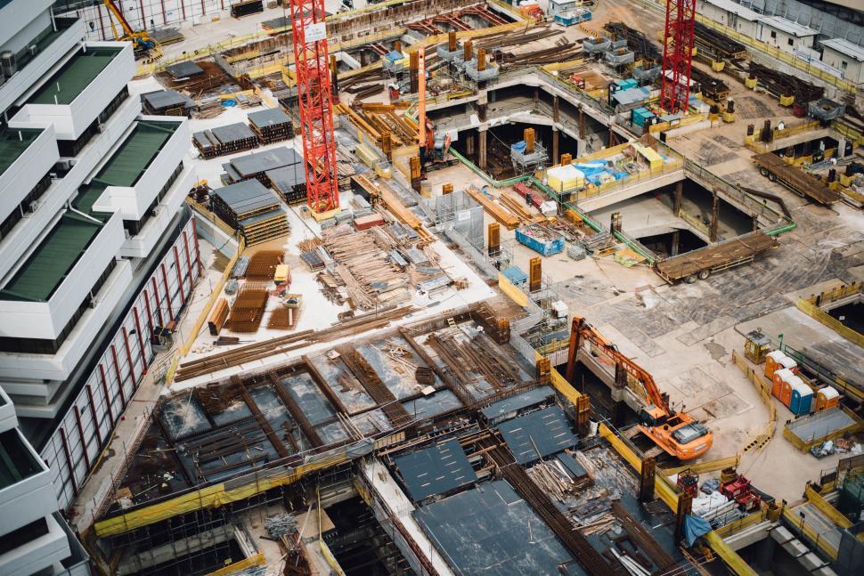
Large construction projects rarely progress in a straight line. Different work fronts move at different speeds, conditions change quickly, and the information teams need depends on what they are reviewing.
Sometimes the priority is understanding how the site is changing as a whole. At other times, it is checking what happened inside a specific area or what was present there at an earlier stage.
Aerial and ground capture help with both. Used together, they make it easier to move from the overall site to the areas that need closer attention.
Start with the wider site view
When work is spread across multiple zones, reviewing progress area by area can make it harder to see how the project is moving as a whole.
Aerial capture gives teams that wider view. Drone imagery, orthomosaics and 3D models can show structural development, earthwork, external works and access routes together, making larger changes easier to identify.
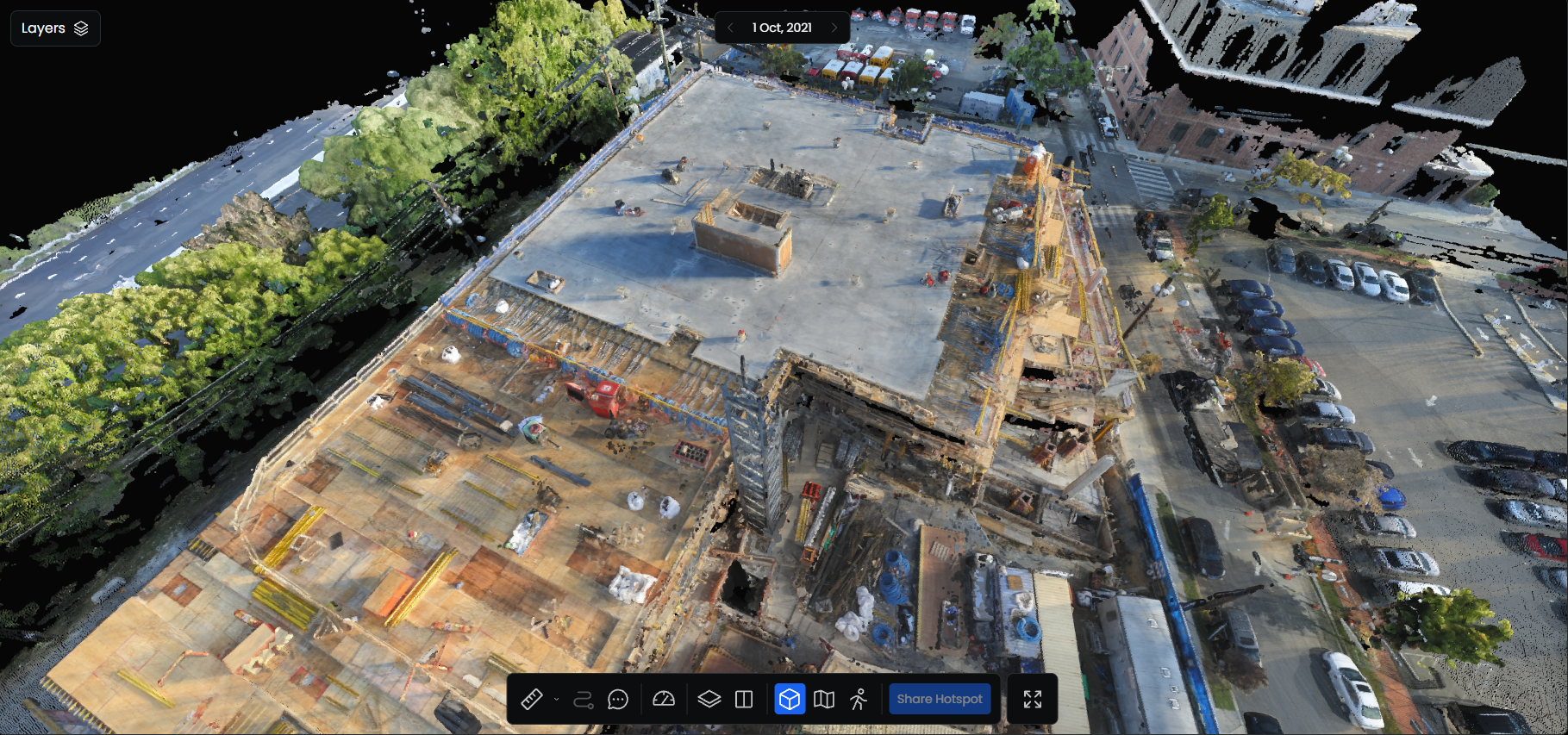
This is especially useful during progress reviews. Teams can see which work fronts have advanced, where activity has shifted and which areas may need a closer look.
That makes the review more focused from the start, rather than spending time piecing together separate updates before deciding where attention is needed.
Then get closer where it matters
Aerial capture can show that a building or structure has progressed, but it cannot always show what is happening inside it.
Different floors may be at different stages. Installations may still be underway. Access conditions may have changed. Some areas may already be ready for the next activity while others are not.
Ground-level 360° capture helps teams review those conditions in context.
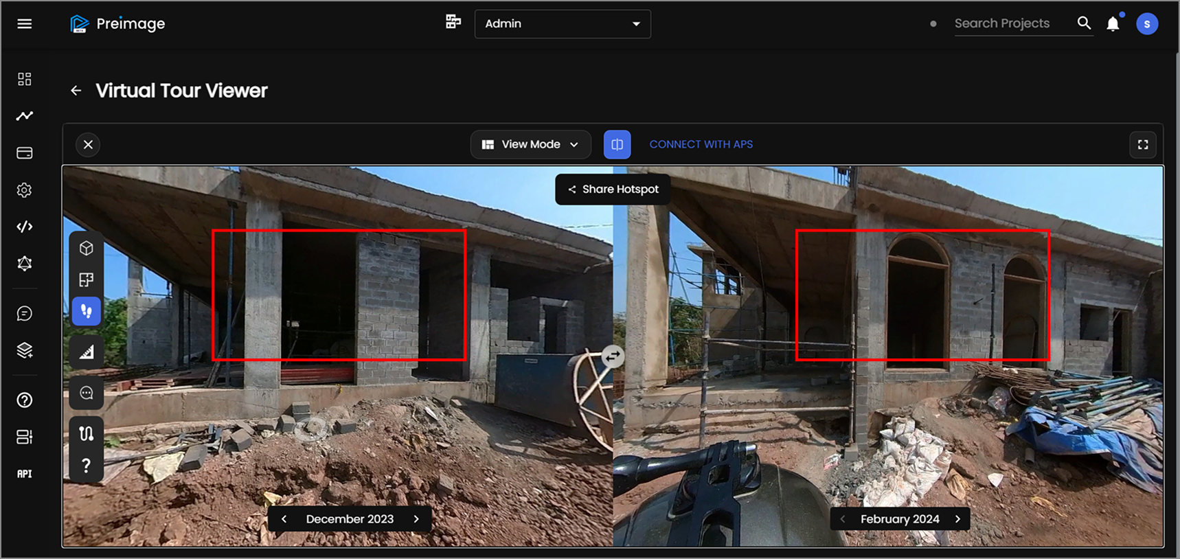
Teams can revisit internal spaces, installations, finishes, structural areas and access conditions without relying only on a few selected photographs. Because the surrounding space is captured as well, it is easier to understand what was happening around the work at that point in time.
Yeshwanthpur Railway Station: using both views on one project
We used aerial and ground capture together while documenting the redevelopment of Yeshwanthpur Railway Station in Bengaluru.
The work is spread across multiple parts of the station, including new structures, platform areas and access infrastructure. On a project like this, reviewing one location in isolation makes it harder to understand how the redevelopment is progressing as a whole.
The aerial capture helps establish that wider context. Teams can see how different parts of the station relate to each other, where major changes are taking place and which areas may need a closer review.
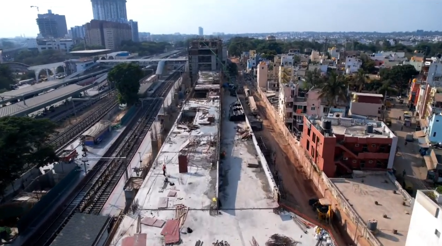
At ground level, the same project can be reviewed much more closely. Teams can see conditions around structures, platforms and active work zones that are difficult to understand from above.
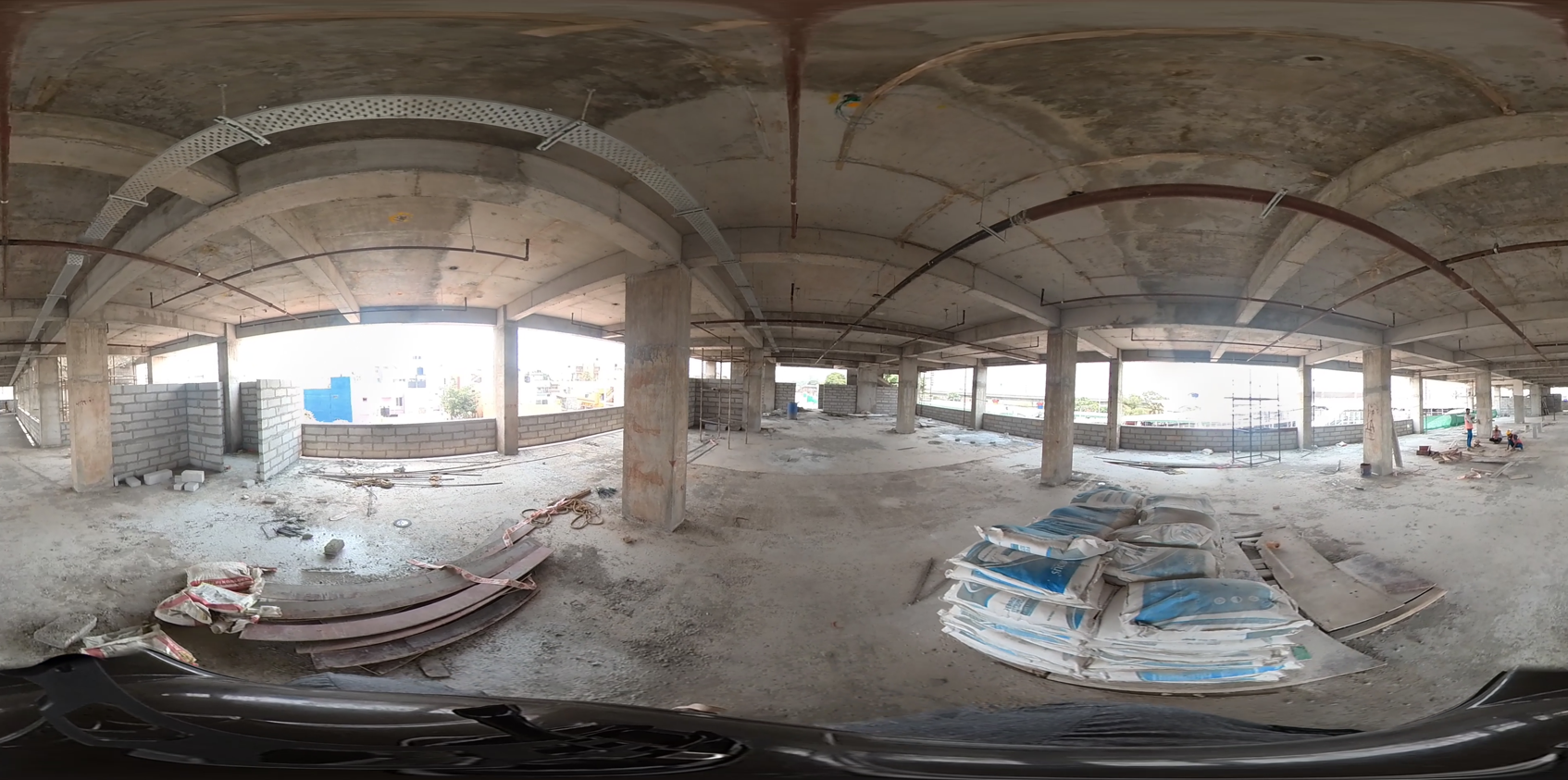
The 360° capture also becomes more useful when it is available as a virtual tour. Instead of looking at a single frame, teams can move through the captured site, look around a specific location and revisit the condition of an area from that date.
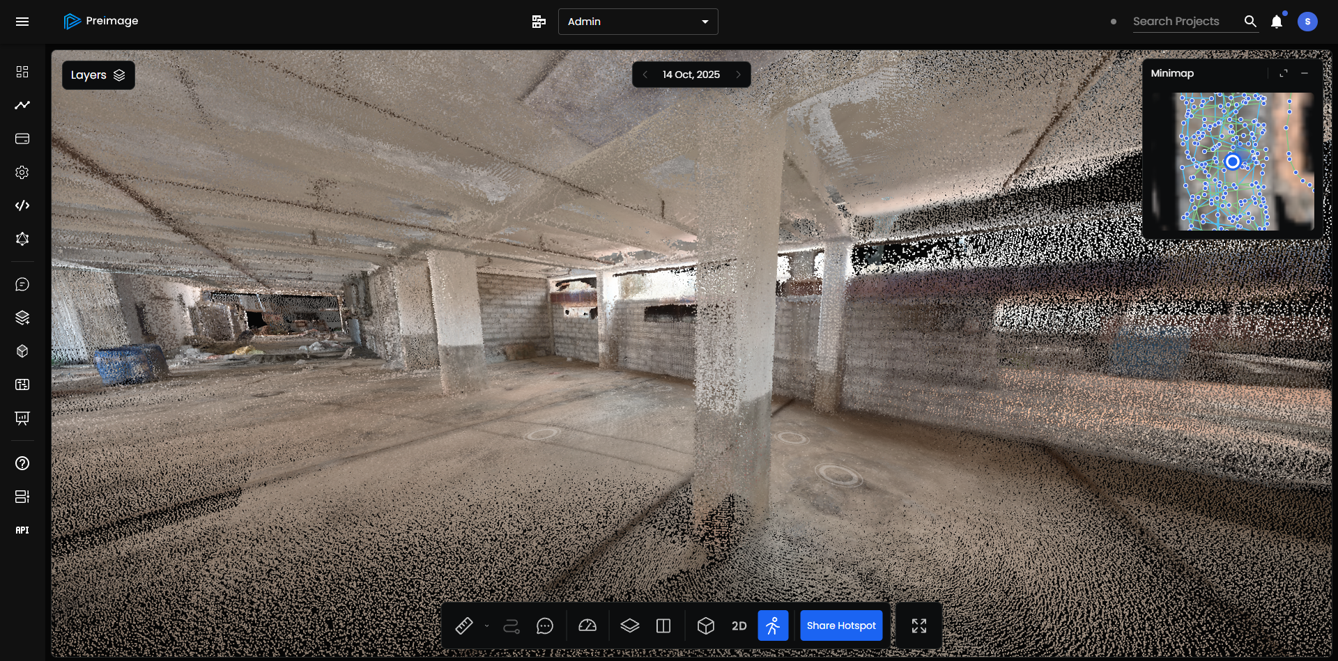
For remote stakeholders, this means better access to the site without depending only on selected photographs or someone else explaining what was visible during a visit. It also gives project teams a common visual reference when a specific area needs to be discussed.
Repeated capture turns documentation into a usable record
A single capture shows what existed on one date. Repeated captures show how the project has changed.
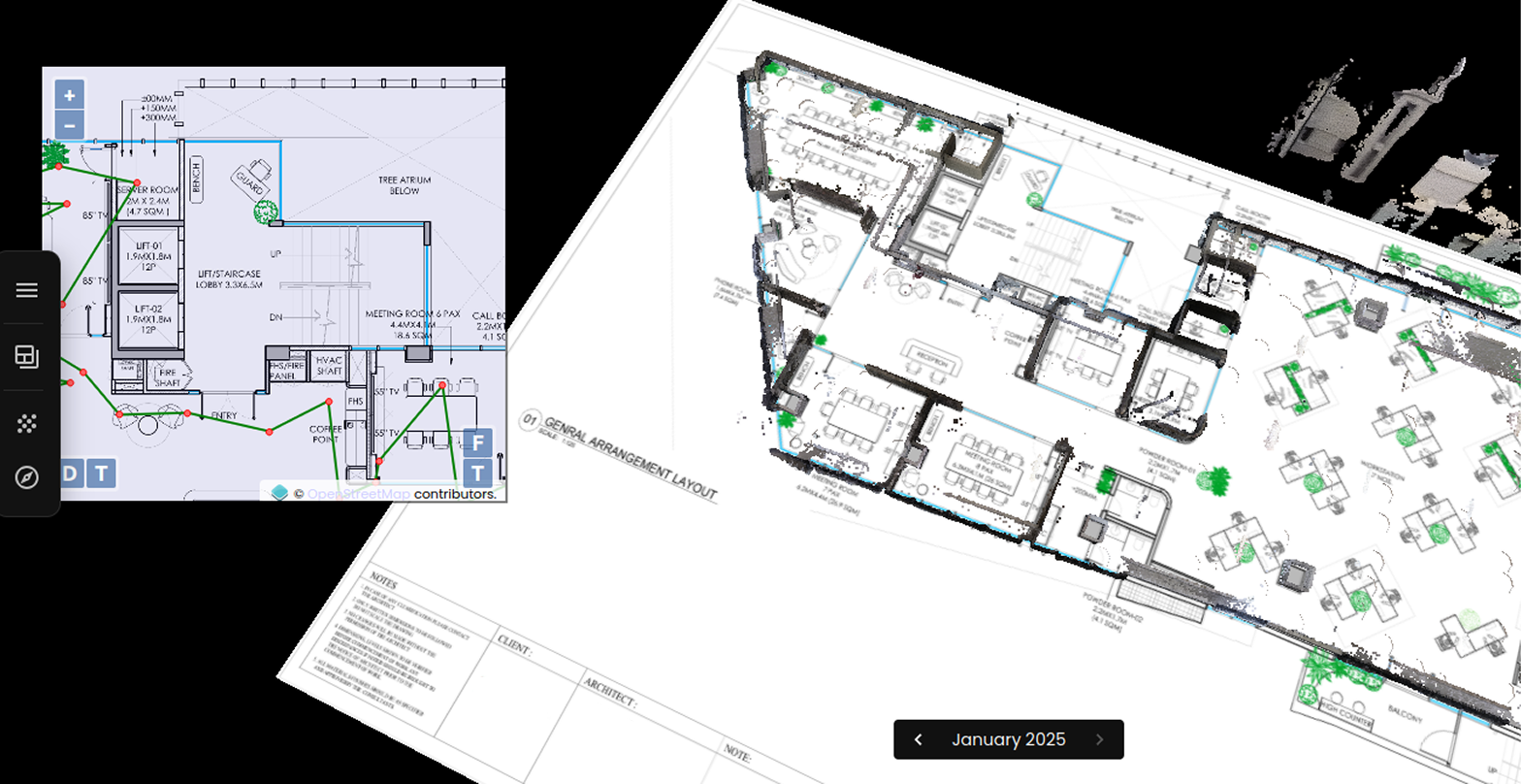
At the site level, teams can compare aerial captures to follow major work fronts over time. At ground level, they can return to the same location and see how an installation, room or work area has progressed.
This becomes particularly useful later in the project. Services may be concealed, ceilings may be closed, temporary access may change, and one trade’s work may be covered by the next.
A dated visual record gives teams a way to return to those earlier conditions instead of trying to reconstruct them from memory or scattered photographs.
Over time, the captures become a reliable record of how the project moved from one stage to the next.
Getting the capture strategy right
The way aerial and ground capture are combined should follow the way the project is progressing.
Aerial capture may be used more frequently across large external work fronts, while ground capture can focus on structures, interiors and areas that need closer review. That balance can change as the project moves from early works into structure, services and finishes.
At Preimage, we work with project teams to understand the site, the construction stage and the information different stakeholders need before planning the capture approach.
The objective is simple: capture the parts of the project that matter, at the level of detail and frequency that will make the information useful throughout construction.
Want to get started on your project? Talk to our team to plan the right aerial and ground capture approach for your site.

.webp)