
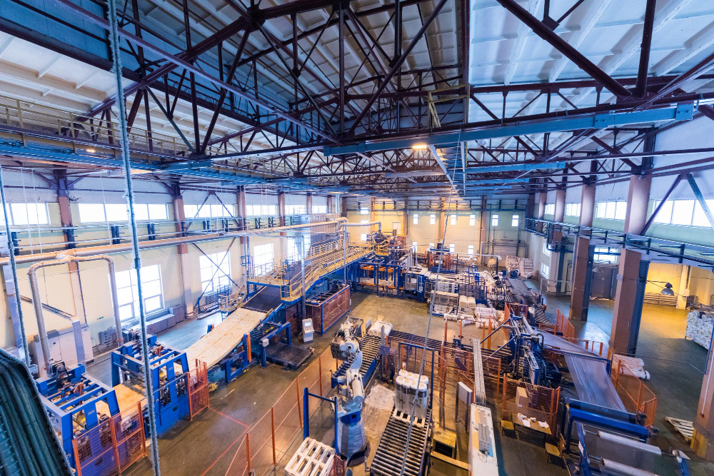
Preimage partnered with a leading consulting firm to digitally reconstruct a 200-acre industrial facility using aerial LiDAR, terrestrial 3D scanning, and ground-penetrating radar (GPR). The objective was to create a precise, unified digital model of the facility to support engineering, planning, and operational workflows.
Over time, the facility had evolved through multiple undocumented modifications. Existing drawings were outdated, utilities were unrecorded, and structural variations were not reflected in available documentation. The project required a reliable way to capture and align actual site conditions into a single, accurate digital environment.
The Challenge: Incomplete As-Built Data in Large Industrial Facilities
Large-scale industrial sites often lack accurate and up-to-date as-built documentation, especially when they have undergone continuous modifications.
Key challenges included:
1. No unified as-built documentation across the facility
Existing drawings did not reflect current site conditions
2. Limited visibility into underground utilities and services
Critical subsurface infrastructure was not mapped
3. Data capture in an active industrial environment
Scanning had to be performed without disrupting operations
4. Structural differences between design and actual site conditions
On-ground realities differed significantly from planned designs
Solution: Multi-Modal Digital Reconstruction
Preimage combined aerial LiDAR, terrestrial 3D scanning, and GPR-based subsurface mapping to capture the facility across above-ground and underground layers. The resulting datasets were aligned into a single spatial system, creating a unified digital base for engineering, validation, and planning.
This workflow enabled the consulting firm to move from fragmented site information to a high-fidelity digital twin that reflected actual facility conditions more accurately.
Deliverables
1. Point Cloud & Segmented Model
%20(1).png)
- High-resolution 3D model of the facility
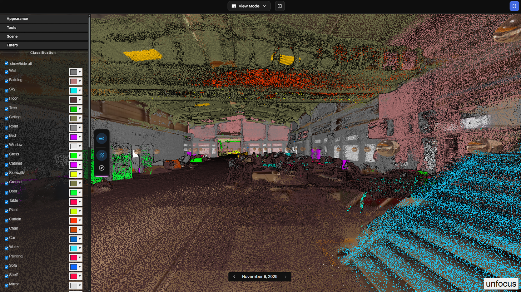
- Segmentation of structural and utility elements
- Integrated above-ground and underground mapping
2. LOD 500 BIM Model
- Engineering-grade BIM model reflecting actual as-built conditions
- Supports planning, coordination, and future interventions
3. Interactive Virtual Tour

- Immersive 360° walkthrough for remote inspection
- Enables teams to review actual site conditions without relying only on drawings
4. Automated Engineering Drawings
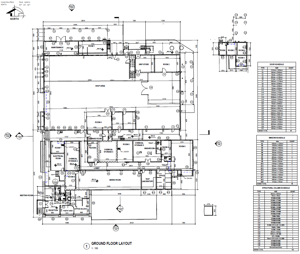
- Drawings generated directly from the digital model
- Reduces manual drafting effort and speeds up documentation
Results: Faster, More Accurate Engineering Workflows
Preimage transformed fragmented site information into a unified digital model of the facility, creating a single source of truth for engineering and operations.
Key Outcomes
- Improved as-built accuracy
- Reduced rework from outdated drawings
- Enhanced underground utility visibility
- Accelerated engineering and planning workflows
- Improved cross-team coordination
- Supported expansion and asset lifecycle planning
By combining LiDAR, GPR, and AI-driven modeling, Preimage created a single source of truth for the facility that now supports expansion planning, maintenance, engineering decisions, and asset lifecycle management.


.webp)